Skip to product information
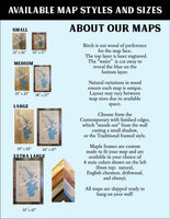
**Please note: Actual layout may vary based on size. If you'd like to see a proof of the layout prior to production, let us know,


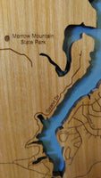
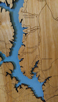
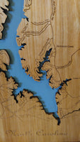
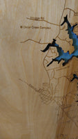
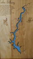
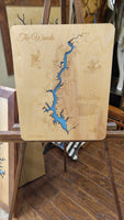
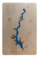
This is a beautiful, detailed, laser engraved and precision cut map, including lake information such as surface area, elevation and maximum depth.
Included With All Maps:
- Points of interest laser engraved into the map face
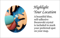
- A blue, self-adhesive Swarovski crystal to mark your preferred location on the map
Our maps are made from beautiful birch plywood. Natural variances in the wood grain ensure a unique work of art. Once the map is cut, it is hand sanded multiple times, mounted on a blue board to highlight the water, and given a clear coat for a lustrous wood shine. Proudly made in the USA by American workers in an American owned business.
**Please note: Actual layout may vary based on size. If you'd like to see a proof of the layout prior to production, let us know,
Custom Engraving Available
Add up to 2 lines of custom engraving at no additional cost!
Standard Engraving:
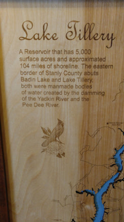
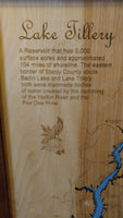
- The reservoir that has 5,000 surface acres and approximated 104 miles of shoreline. The eastern border of Stanly county abuts Badin Lake and Lake Tillery, both were manmade bodies of water created by the damming of the Yadkin River and the Pee Dee River. You can choose the stand out map which is mounted onto a tranquil blue back with a key hole cut on the back, ready to hang.