Skip to product information
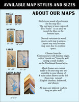
**Please note: Actual layout may vary based on size. If you'd like to see a proof of the layout prior to production, let us know,


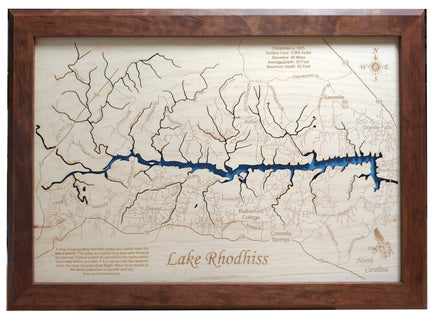
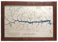
This is a beautiful, detailed, laser engraved and precision cut map, including lake information such as surface area, elevation and maximum depth.
Included With All Maps:
- Points of interest laser engraved into the map face
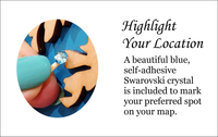
- A blue, self-adhesive Swarovski crystal to mark your preferred location on the map
Our maps are made from beautiful birch plywood. Natural variances in the wood grain ensure a unique work of art. Once the map is cut, it is hand sanded multiple times, mounted on a blue board to highlight the water, and given a clear coat for a lustrous wood shine. Proudly made in the USA by American workers in an American owned business.
**Please note: Actual layout may vary based on size. If you'd like to see a proof of the layout prior to production, let us know,
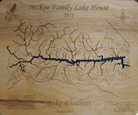
Custom Engraving Available
Add up to 2 lines of custom engraving at no additional cost!
- Completed in 1925
- Surface Area: 3,060 Acres
- Shoreline: 90 Miles
- Average Depth: 20 Feet
- Maximum Depth: 52 Feet
- A view of surrounding mountain peaks and wildlife make the lake a beauty. The water is a crystal clear blue color because the lake has a sandy bottom as opposed to the murky waters that a clay bottom provides. It is a narrow river-like reservoir within the large Catawba River Basin. About three fourths of the lake's watershed is forested and only three percent developed.